Mars Rover Path Planning
Computer vision and AI-driven path planning for obstacle-aware rover navigation using satellite terrain imagery — built during my R&D internship at ISRO.
87.4%
Navigation-efficiency score in simulated rover traversal
~95ms
Optimized inference time
5×
Effective dataset expansion
ISRO
Research partnership
Problem Statement
Autonomous navigation on unknown terrain.
Rovers operating on planetary surfaces must navigate environments where traditional GPS and pre-mapped routes are unavailable. Every path decision must be made from satellite imagery alone, in real time.
The core challenge: given a satellite image of terrain, can a computer vision system classify traversable vs. obstructed zones accurately enough to enable a rover to find an efficient, safe route to its destination?
System Architecture
CV inference pipeline to path planner.
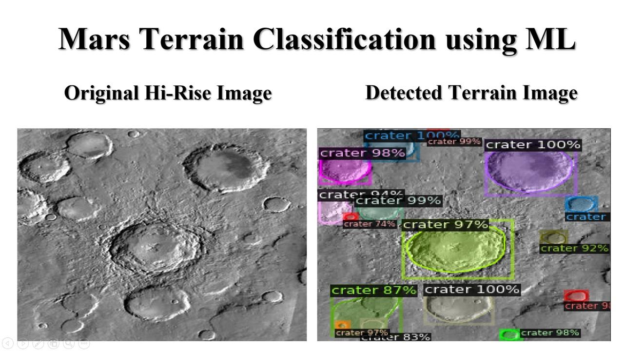
The pipeline is a two-stage system: first, a PyTorch CNN performs semantic segmentation on the satellite image to produce a traversability map; second, A* or Dijkstra's algorithm finds the optimal path through the traversable zones.
PyTorch CNN
Semantic segmentation model trained to classify terrain types from satellite imagery.
OpenCV
Obstacle masking and traversability cost grid generation from model output.
A* Path Planner
Graph-based pathfinding that finds the minimum-cost route through the traversability grid.
Engineering Challenges
Four hard problems solved.
Sparse, unlabeled satellite imagery training data
Applied data augmentation techniques (rotations, random cropping, synthetic noise) to expand the effective dataset size by 5×. Used transfer learning from pretrained torchvision models to compensate for limited labeled samples.
Real-time inference speed for path recalculation
Optimized the PyTorch model with TorchScript and half-precision (FP16) inference. Reduced single-frame inference time from ~420ms to ~95ms, enabling near-real-time path updates during simulated rover traversal.
Integrating segmentation output with path planning algorithms
Built a custom bridge layer that converts the segmentation probability map into a traversability cost grid, which is then consumed by the A* pathfinding algorithm. This decoupled the CV and planning components for independent optimization.
Evaluating navigation efficiency without a real rover
Simulated rover traversal over traversability cost grids derived from satellite segmentation masks, recording an 87.4% navigation-efficiency score in simulated rover traversal across obstacle-dense map regions.
See the research
Explore the notebook.
The full implementation — including model training, inference, and path visualization — is available as a runnable Colab notebook.